ALN logo; link to Arid Lands Newsletter Home page No. 51, May/June 2002
Using geospatial technologies to understand dryland dynamics

Bryant Figure 7: Image profiles and lake areas

A.
Profiles for Oshigambo Bay and Poacher Inlet

Profiles for Oshigambo Bay and Poacher Inlet
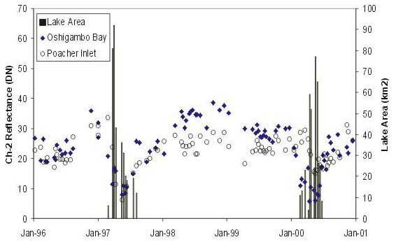
B. Profiles for Fishers Pan, Andoni Bay and the western end of Etosha Pan (Western Basin)
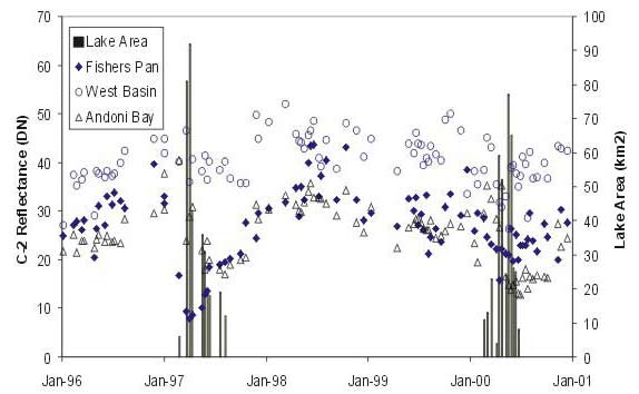
 Profiles for Fishers Pan, Andoni Bay and the western end of Etosha Pan (Western Basin)

[Back to the article text]

Link to ALN home page Link to index page for back web issues Link to index page for pre-web issue archive Link to ALN #51 table of contents