Using geospatial technologies to understand dryland dynamics
![]() No. 51, May/June 2002
No. 51, May/June 2002
Using
geospatial technologies to understand dryland dynamics
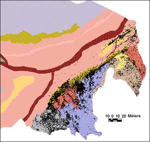 |
Part of the Stud Creek study area, showing about 24,000 artefact locations as a GIS point coverage superimposed over a landform unit polygon coverage. |