Using geospatial technologies to develop
participatory tools for natural resources management
![]() No. 53, May/June 2003
No. 53, May/June 2003
Using geospatial technologies to develop
participatory tools for natural resources management
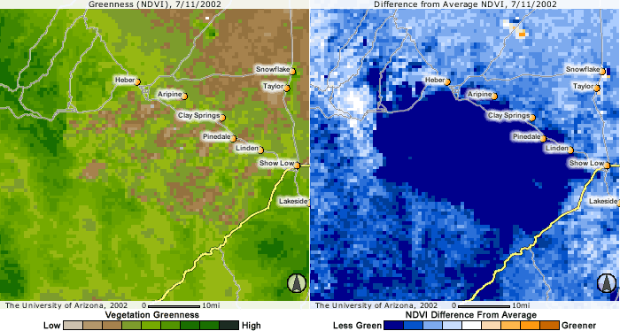
MODIS 250 meter NDVI imagery provides improved resolution for interpreting and assessing vegetation greenness dynamics across landscapes. The 250-m resolution image (left) shows greater variation in greenness than the 1000-m resolution image (right), both in the mountainous region to the northeast of Tucson, and in the desert region to the south. |