Using geospatial technologies to develop
participatory tools for natural resources management
![]() No. 53, May/June 2003
No. 53, May/June 2003
Using geospatial technologies to develop
participatory tools for natural resources management
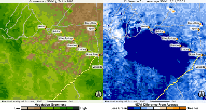
These biweekly NDVI (left) and difference from average NDVI (right) composite images from AVHRR satellite sensors date from July 2002 and show the area of the massive Rodeo-Chediski wildfire area in Arizona, southwestern US. The Rodeo-Chediski fire burned more than 467,000 acres (just under 199,000 hectares). |