Using geospatial technologies to develop
participatory tools for natural resources management
![]() No. 53, May/June 2003
No. 53, May/June 2003
Using geospatial technologies to develop
participatory tools for natural resources management
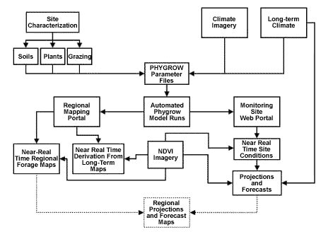
source: GL-CSRP Livestock Early Warning System (LEWS) |
This diagram shows the automated system that enables LEWS to acquire weather data, run the forage product simulation model, and package the output into a series of formats for delivery to different audiences. |