Using geospatial technologies to develop
participatory tools for natural resources management
![]() No. 53, May/June 2003
No. 53, May/June 2003
Using geospatial technologies to develop
participatory tools for natural resources management
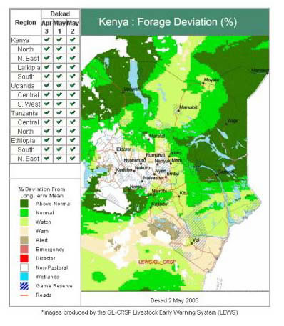
This example map uses the mapping categories developed by the LEWS program to express current forage conditions in LEWS countries (that is, the percent deviation from the long-term average daily grazed forage standing crop). |
 |