Using geospatial technologies to develop
participatory tools for natural resources management
![]() No. 53, May/June 2003
No. 53, May/June 2003
Using geospatial technologies to develop
participatory tools for natural resources management
| This preliminary sketch map of one of the study areas of this project, was produced by local participants in the project. It is thus based on local perceptions of agroecological zones within the study area. Production of such sketch maps for each study areas was one of the first steps in producing georeferenced maps of the study area that incorporate indigenous knowledge of agroecological zones. | 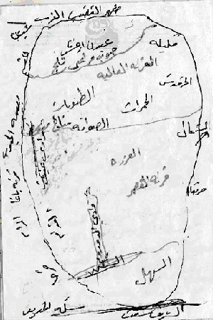 |