ALN logo; link to Arid Lands Newsletter Home page No. 55, May/June 2004
Fire ecology II

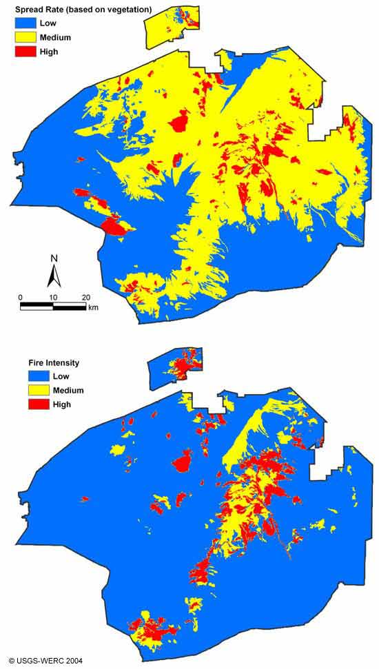
Brooks et al., Fig. 2: Initial, vegetation-based fire spread rate and intensity maps for the Mojave National Preserve

2 vegetation-based maps of predicted fire spread rates and predicted fire intensity within the Mojave National Reserve

These maps were generated using predicted fire spread rates and intensity based solely on vegetation properties of the 76 cover categories defined by the authors for the Preserve.

[Back to the article text]

Link to ALN home page Link to index page for back web issues Link to index page for pre-web issue archive Link to ALN #55 table of contents