Using geospatial technologies to develop
participatory tools for natural resources management
![]() No. 53, May/June 2003
No. 53, May/June 2003
Using geospatial technologies to develop
participatory tools for natural resources management
| This image represents how the geostatistical technique of co-kriging can be used to combine point data from small areas (PHYGROW samples) and combine them with regional NDVI data in order to extrapolate and map forage conditions over large landscapes. | 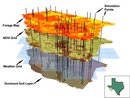 source: GL-CSRP Livestock Early Warning System (LEWS) |