|
Southwest
U.S. Cool Season Climate Summaries The southwest U.S. has a unique seasonal-transition climate
characterized by distinct wet and dry seasons that emerge throughout the
annual cycle. In Arizona and New Mexico the annual pattern of precipitation is
largely defined by the dramatic onset of the summer monsoon thunderstorm
activity in late June that persists through late September and the gradual
onset of winter storms in late October that can persist through late spring.
Winter or ‘cool season’ (defined here are October-May) precipitation comes
largely in the form of large-scale, synoptic storms with widespread
precipitation often in the form of snow at higher elevations. Cool season
precipitation is critical in supporting many ecosystems, agricultural
activities and water resources across the region and requires careful
monitoring to determine drought status and to anticipate any impacts that may
emerge. Typical drought monitoring products or seasonal climate summaries
report totals and averages with respect to precipitation, but often fail to
capture the subtle shifts in the timing, type, intensity and frequency of
precipitation events as well as associated temperature variability that can
create drought impacts. These station-level climate summary plots work to
present many different variables that can be calculated from daily
precipitation and temperature observations to depict sometimes subtle
variations climate that can occur across the southwest U.S.
|
|||||||||||||||||||||||||||||||||||||||||||||||||||||||||||||||||||||||||||||||||||||||||||||||||||||||||||||||||||||||||||||||||||||||||||||||||||
|
Plot
interpretation guide (Coming soon) |
|||||||||||||||||||||||||||||||||||||||||||||||||||||||||||||||||||||||||||||||||||||||||||||||||||||||||||||||||||||||||||||||||||||||||||||||||||
|
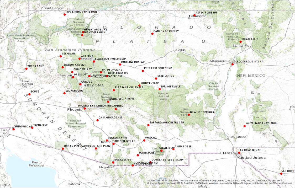
Summary Plot Station Locations
|
|||||||||||||||||||||||||||||||||||||||||||||||||||||||||||||||||||||||||||||||||||||||||||||||||||||||||||||||||||||||||||||||||||||||||||||||||||
|
Links to station plots
|
|||||||||||||||||||||||||||||||||||||||||||||||||||||||||||||||||||||||||||||||||||||||||||||||||||||||||||||||||||||||||||||||||||||||||||||||||||
|
Other SW cool season climate resources:
Climate Science Applications Program
- University of Arizona Cooperative Extension
Last Updated: 12/9/15 © 2015 The Arizona Board of Regents. All contents copyrighted. All rights reserved.
|