|
Southwest
U.S. Monsoon Season Technical Summaries The summer thunderstorm or 'monsoon' season in the southwest
U.S., including Arizona and New Mexico, provides precipitation that is critical
in supporting local eco- and agricultural systems that depend on the summer
moisture. Summarizing monsoon season precipitation activity
for drought monitoring or climate impact assessments is typically done
through monthly or seasonal totals. This approach is quick and simple, but
provides limited insight into how monsoon thunderstorm activity delivered
precipitation to the region throughout the season, including the frequency
and intensity of rainfall events. Gauging the intensity (heavy vs. light
events), timing (early vs. late season activity) and distribution (frequent
or infrequent bursts and breaks in activity) of precipitation events through
the summer season can complement monthly and seasonal totals in
assessing monsoon season precipitation as a whole.
Companion monsoon maps posted here: Arizona & New Mexico |
||||||||||||||||||||||||||||||||||||||||||||||||||||||||||||||||||||||||||||||||||||||||||||||||||||||||||||||||||||||||||||||||||||||||||||||||||||||||||||||||||||||||||||||||||||||||||||||||||||
|
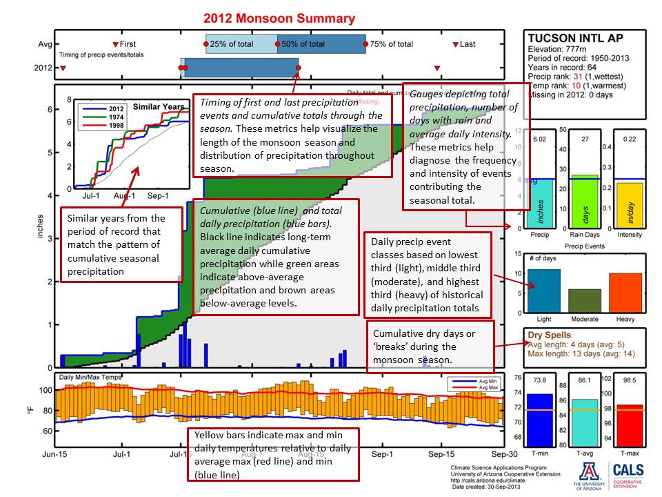
A guide to interpreting the plots can be found by clicking here. |
||||||||||||||||||||||||||||||||||||||||||||||||||||||||||||||||||||||||||||||||||||||||||||||||||||||||||||||||||||||||||||||||||||||||||||||||||||||||||||||||||||||||||||||||||||||||||||||||||||
|
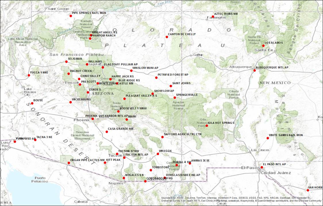
Summary Plot Station Locations
|
||||||||||||||||||||||||||||||||||||||||||||||||||||||||||||||||||||||||||||||||||||||||||||||||||||||||||||||||||||||||||||||||||||||||||||||||||||||||||||||||||||||||||||||||||||||||||||||||||||
|
Links
to station plots
|
||||||||||||||||||||||||||||||||||||||||||||||||||||||||||||||||||||||||||||||||||||||||||||||||||||||||||||||||||||||||||||||||||||||||||||||||||||||||||||||||||||||||||||||||||||||||||||||||||||
|
Other SW monsoon season resources:
Climate Science Applications Program
- University of Arizona Cooperative Extension
Last Updated: 06/07/19 © 2019 The Arizona Board of Regents. All contents copyrighted. All rights reserved.
|