RESEARCH
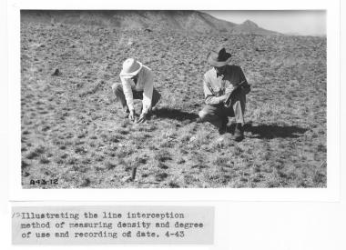
1943 04 xx line intercept density.jpg
The Santa Rita Experimental Range (SRER) is the oldest research area in the United States. Founded in 1902 to protect the native rangeland from grazing and to conduct research on problems associated with livestock production, it has been a principal site for pioneer range research with the purpose to build a sound body of scientific knowledge to further the restoration, protection, and management of semiarid grasslands in the Southwest. Since its foundation, this outdoor laboratory has provided a powerful source for long-term ecological studies. The accumulated information collected on the SRER as well as the long-term historical and biological databases maintained since its creation are more complete than for any other research area (Martin and Reynolds 1973) and still fully available to researchers worldwide. Results of this research have had direct applicability to over 20 million acres of semiarid rangelands in the United States and to another 20 million acres in northern Mexico.
In the early 1970s, the USD Agricultural Research Service Southwest Watershed Research Center established 8 instrumented watersheds that record rainfall, runoff, and sediment yield for each storm event. Those watersheds have been the site of several land use treatments and resulting publications. Data from the watersheds can be obtained at https://www.tucson.ars.ag.gov/dap/.
Beginning 2012, the National Ecological Observatory Network (NEON) established a 30-year research program measuring atmospheric and ecosystem gas exchanges, invertebrates, reptiles, birds, mammals, and soil properties. The NEON program on the SRER is referred to as the Desert Southwest Domain Center, and all data collected is available to the public at https://www.neonscience.org/data-samples. The NEON data for the SRER are available on this website at NEON.
A debt of gratitude is expressed to all scientists who contributed to these efforts. A special appreciation goes to
Dr. S. Clark Martin (1916-2002) who dedicated most of his professional career (55+ years) and retirement to conducting and organizing research, transferring technology to ranchers, resource managers, and scientists, securing the integrity of historical data, and photo records, and assisting graduate students with their research on the SRER. Another special recognition goes to
Dr. David Griffiths (1867-1935), a pioneer in rangeland dynamics, whose work dating to the turn of the century provided the basis for the establishment of the SRER and whose photo collections provide an opportunity to view the past (Medina 1996).
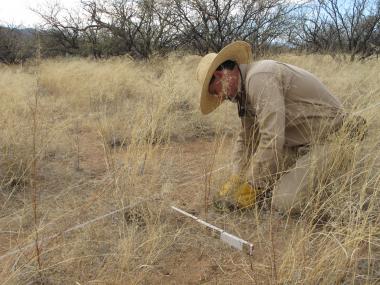
Vegetation Transects_McClaran.JPG
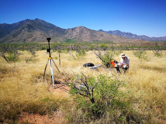
It is obvious that the vast opportunities for research on the Santa Rita Range are currently built on this rich legacy of more than a century of observation and research. However, in addition to these opportunities, there are also obligations to maintain and add to this legacy. Continuing the systematic measurement and repeat photography efforts as well as supporting the development of research on the Santa Rita represent the greatest opportunity for improving our understanding of future changes in the southwestern rangelands and ensure a second century of research on the Santa Rita (McClaran 2003). Scientists are therefore encouraged to conduct their studies on the SRER and on the SRER DATA RESOURCES. The contents listed below provide all information necessary to this end. Moreover, forms, procedures, rules, examples of ongoing projects, as well as the complete list of Publications already existing on the Santa Rita, are available for consultation and download. Opportunities for lodging at the SRER while doing research are also provided with all annexed information.
References
Martin, S. Clark; Reynolds, Hudson G. 1973. The Santa Rita Experimental Range: Your facility for research on semidesert ecosystems. Journal of the Arizona Academy of Science. 8: 56-67.
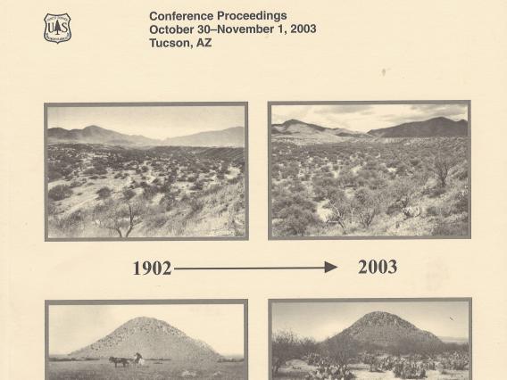
McClaran, Mitchel P. 2003. A Century of Vegetation Change on the Santa Rita Experimental Range. Santa Rita Experimental Range: 100 years (1903 to 2003) of accomplishments and contributions; conference proceedings; 2003 October 30 November 1; Tucson, AZ. Proc. RMRS-P-30. Ogden, UT: U.S. Department of Agriculture, Forest Service, Rocky Mountain Research Station. 16-33.
Medina, Alvin L. 1996. The Santa Rita Experimental Range: History and Annotated Bibliography (1903-1988). General Technical Report RM-GTR-276 Rocky Mountain Forest and Range Experiment Station Forest Service U.S. Department of Agriculture. 67 p.
Research Policies
Data Use Policies
Drone Use Policy
Insurance Policies
Product Testing Policies
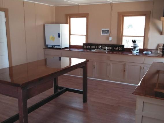
Research Equipment and Lab Space
Learn more about the
Wi-Fi connection options and
Lab Space available on the SRER.
Recent Publications - 1986 to present
Proceedings from the Centennial Conference 2003
Annotated Bibliography (1903-1988)