Two major wildfires have damaged critical red squirrel habitat within the red squirrel refugium on Mt. Graham. The human-caused Clark Peak Fire began in 1996 and damaged 2600 hectares and the Nuttall Fire complex was a merging of two lightning-caused fires in 2004 that damaged 12,029 hectares.
|
|
|
|
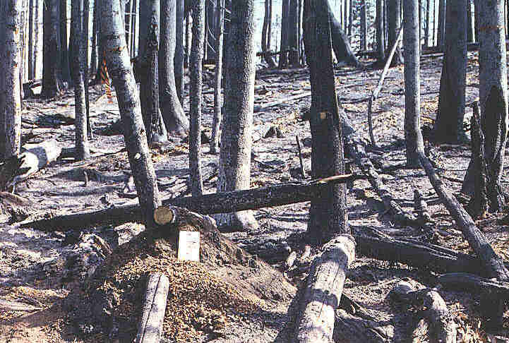
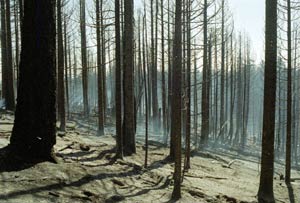
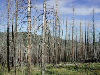
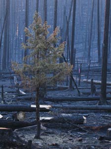
| Clark Peak Fire - Fall 1996 | Clark Peak Fire - Fall 1996 | Clark Peak Fire - Summer 2001 |
The Clark Peak fire was a human-caused fire that started on April 24, 1996 in the Riggs Lake area at the northwest end of the mountain range. The fire was contained at about 6500 acres (2600 ha) by May 9. Several areas within the burn were known to contain midden sites of the endangered Mt. Graham red squirrel. Within the RSMP study area, 24.5 hectares of spruce-fir habitat was burned (a 23% reduction from the original 205 hectares), and 34 hectares of mixed conifer transitional habitat was burned (a 32% reduction from the original 106 hectares).
Although the fire encompassed over 2600 ha, not all of the forest within that area was totally destroyed. Some of the red squirrel middens within the burned area were completely destroyed, but others escaped without any damage. The USDA-Forest Service estimates that about 50 percent of the middens within the burned area were destroyed, but the remaining middens were still suitable for red squirrel habitation.
Most of the burn on the University of Arizona monitored areas (approximately 34 ha in the mixed-conifer habitat and 24.5 ha in the spruce-fir habitat) was very intense and completely destroyed the forest. Thirty-three midden sites were destroyed and several more damaged by less intense ground fires. Twenty-three of the destroyed middens had been occupied by red squirrels before the fire began. After the fire, only one destroyed midden, which was close to an unburned area, continued to be occupied for the next 2 months. Another midden was occupied until mid-June.
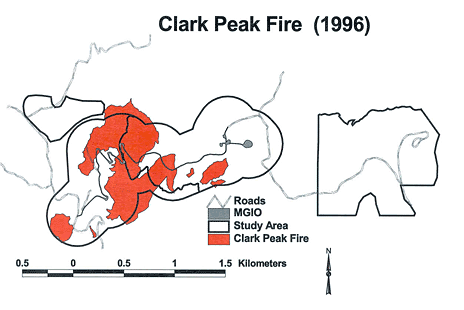
Below is a map depicting damage to the RSMP study areas by the Clark Peak Fire.
 |
 |
 |
 |
Nuttall fire damage, photo UAPD |
Nuttall fire approaching meadow, photo UAPD |
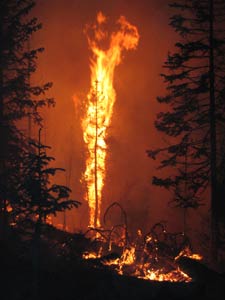
Nuttall fire engulfing tree, photo R. Smallwood |
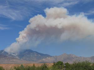
View of early Nuttall fire from the valley, photo UAPD |
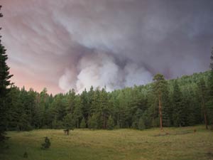
The Nuttall Fire Complex began as two lightning-caused fires on 22 June 2004 (Gibson Fire) and 26 June 2004 (Nuttall Fire) and the two fires merged on 2 July 2004. The fire perimeter covered most of the northeast half of the Pinaleño range at elevations from 1,371 m to the highest point in the range, Mt. Graham at 3,267 m. The fires were contained after 19 July 2004, and the USFS Burned Area Response Team (BAER) estimated the total fire size at 12,029 hectares. Of this area, 6,354 hectares were categorized as low to unburned burn severity, 4,593 hectares at moderate severity, and 1,083 hectares at high severity. Within the RSMP study area, 88 hectares of spruce-fir habitat was burned (a 43% reduction from the original 205 hectares). For more information and photos, visit the Southwest Area Incident Management Team's website or the Large Binocular Telescope Observatory's website.
As with the Clark Peak fire, not all of the middens within the burn perimeter were totally destroyed. Whereas the Clark Peak fire damaged more middens in the mixed conifer transitional habitat, the Nuttall Fire Complex hit the spruce-fir habitat the hardest. During the 2004 census of middens within the RSMP study area, each midden was visited and assessed for damage to the substrate, vegetation, and canopy layers within a 10 m radius of the cone scale pile. Prior to the Nuttall Fire, there were 388 known middens within and just outside of the RSMP study areas. Of these, 114 or nearly 30% were severely burned, the majority of these middens (90%) were in the higher-elevation spruce-fir habitat. Twenty five middens were lightly or moderately burned (6% of total), and all of these middens were located in the spruce-fir habitat. In addition, 15 middens (4% of total) were damaged by fire suppression efforts - almost all of these (14) were in spruce-fir habitat.
Twenty radio-collared squirrels were directly affected by the Nuttall complex fire, occupying 20 middens within the burn perimeter. Of these 20 middens, 15 were severely burned and 35% of the collared squirrels occupying these middens did not survive the fire (Koprowski et al. 2006). Currently, research is underway to determine to what degree red squirrels utilize these burned areas.
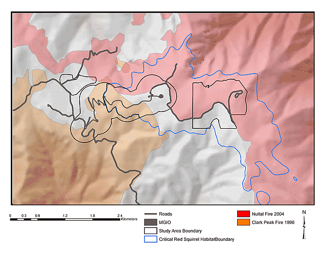
Below is a map of the Clark Peak and Nuttall Fire Complex burn perimeters in relation to RSMP study areas and the red squirrel refugium (areas above 10,000 ft) on Mt. Graham.
This site maintained by the Mt. Graham Biology Program - The University of Arizona.
If you have any questions or comments please email us at:RSMP@ag.arizona.edu