Sonoita AVA
The Sonoita American Viticultural Area
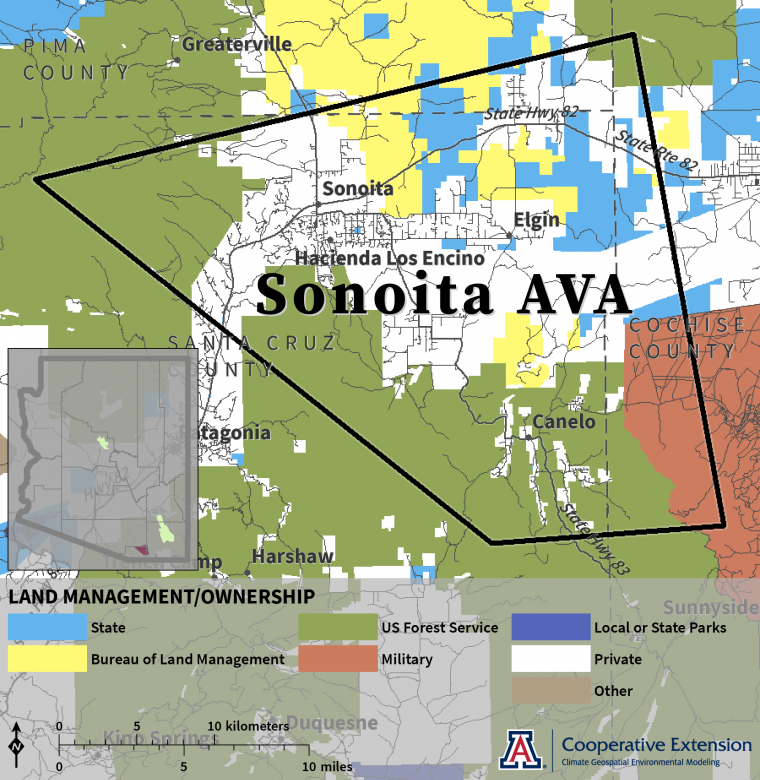
Established in October 19841, the Sonoita AVA in southeastern Arizona covers an area in extreme west-central Cochise, extreme southeastern Pima, and northeastern Santa Cruz counties between the Santa Rita, Huachuca, and Whetstone mountains.
The Sonoita AVA covers an area of about 319 square miles. About 126 square miles (39%) of the AVA is privately owned land. Federal and state entities manage the remainder2. The perimeter of the AVA follows the boundary description as published in the Federal Register and based on U.S. Geological Survey topographic maps1.
sonoita-ava-location-map-web.png