Sonoita AVA Topography Maps
< Back to Sonoita AVA Topography
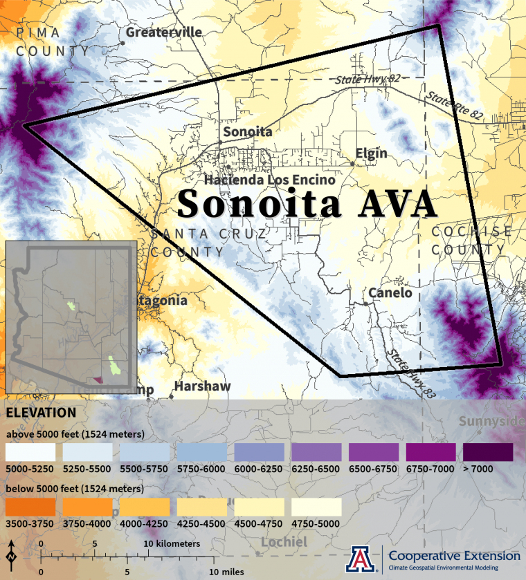
Elevation
For much of the Sonoita AVA, elevations are between 4,500 and 5,500 feet (1,372 and 1,676 meters).1,2 Higher elevations, some of which exceed 7,000 feet (2,134 meters), occur in the northwest, northeast, and southeast parts of the area.
Elevation creates pronounced differences in temperature and precipitation. Average temperatures at higher elevations are cooler than those at lower ones. Average precipitation amounts at higher elevations are greater than those at lower ones.
sonoita-ava-elevation-web.png
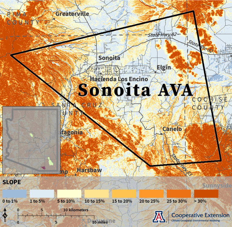
Slope
The north-central, northeastern, and central parts of the Sonoita AVA mostly have slopes less than 5%.1 Slopes for much of the east- and south-central parts are between 5% and 30%. Areas along the western and southern boundaries commonly have slopes greater than 30%.
Slope represents the change in elevation across an area. It can influence the amount of sunlight directly reaching vines and thus temperatures within a vineyard, as well as cold-air drainage, water infiltration, soil erosion, and use of vineyard equipment.
sonoita-ava-slope-web.png
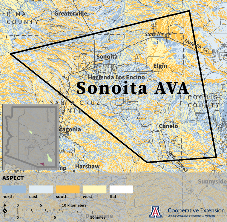
Aspect
Many areas across the north-central, central, and east-central parts of the Sonoita AVA face north or east.1 Much of the northeastern area faces south or west, as do areas in the far southeast and along the western boundary.
Aspect is the cardinal direction that a slope faces. Like slope, it can modulate sunlight that directly reaches vines and thus temperatures within a vineyard. Locations with south- and west-facing slopes experience higher values of these environmental conditions.
sonoita-ava-aspect-web.png
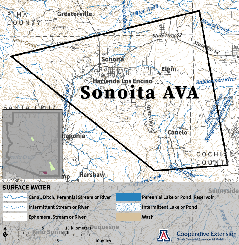
Surface Water
Ciénega Creek, Babocomari River, and Sonoita Creek drain out of the Sonoita AVA to the north, east, and west, respectively.3 Turkey Creek drains into the southern part. Much of the AVA is dissected by ephemeral streams.
Natural features that are perennial, intermittent, or ephemeral and engineered features like canals, ditches, and reservoirs make up surface water. In addition to directing water across a landscape, these features can channel cooler air from higher elevations to lower ones on nights with little to no wind, influencing spring and fall freeze risk as well as diurnal temperature range during summer.
sonoita-ava-surface-water-web.png