NEON Airborne Remote Sensing at SRER
NEON’s Airborne Remote Sensing surveys take place across the Observatory during peak greenness. Sensor operators collect high-resolution data at low altitude while observational and instrumented ground sampling is occurring. The concurrent collection of all three systems (airborne sensors, automated instruments, observational sampling) is important for scaling NEON data to regional and continental scales.
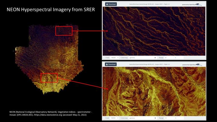
The airborne flight payload is housed inside a Twin-Otter aircraft and includes a discrete and full-waveform lidar, a hyperspectral imaging spectrometer, and a high-resolution RGB camera. These instruments collect information on surface geology, topography, vegetation structure, and plant biochemistry. You can learn more information about NEON’s sensor payload and the 29 different data products produced by NEON’s Airborne Observation Platform.
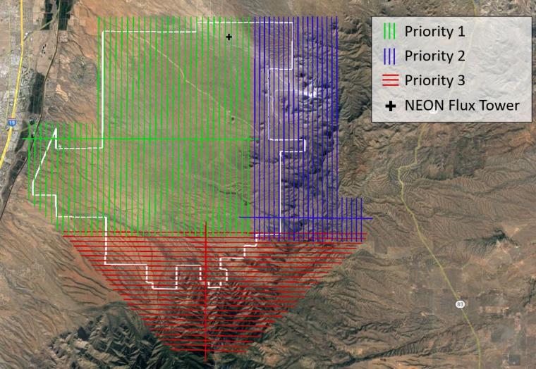
The peak green flight window at SRER—early August to early September—is during summer monsoon season, and provides ample time for flight crews to collect high-resolution data during optimal conditions (no cloud cover, high solar angle). The NEON flight box at SRER is divided into three priority areas, with priority one coverage above NEON’s Terrestrial Instrument Systems and flux tower air shed, where key observational measurements take place.
NEON_SRER Priority Flight Box.JPG
NEON’s airborne remote sensing platform produces open data which are freely available. Visit NEON’s Data Portal to explore and download open remote sensing data from SRER and other NEON sites. Additionally, the airborne infrastructure can also be considered as a platform for Principal Investigators to propose additional research through NEON’s Assignable Assets Program. Because NEON does not own any of the land on which NEON infrastructure operates, research teams are responsible for obtaining any required research permits and site access permission prior to any work being conducted. Learn more about NEON’s Assignable Asset Program and how NEON can support additional research activities.
NEON_AOP Data example.jpg