Water and Carbon Exchange Study Background
Vast networks of meteorological sensors ring the globe measuring atmospheric state variables, like temperature, humidity, wind speed, rainfall, and atmospheric carbon dioxide, on a continuous basis. These measurements serve earth system science by providing inputs into models that predict weather, climate and the cycling of carbon and water. And, they provide information that allows researchers to detect the trends in climate, greenhouse gases, and air pollution. Yet, to understand how and why atmospheric state variables may vary in time and space, scientists need to quantify the flows, or fluxes, of trace gases like water vapor or carbon dioxide between land and the atmosphere.
“Biometeorologists” deploy specialized instrumentation and use a technique called eddy covariance to measure fluxes of trace gases between ecosystems and atmosphere. Fluxes are measured by computing the covariance between the vertical velocity and target trace gases at each individual site to capture the action of turbulet eddies in moving water vapor, carbon dioxide, heat and other quantities in the atmosphere. Key attributes of the eddy covariance method are its ability to measure fluxes directly, in situ, without invasive artifacts, at a spatial scale of hundreds of meters, and on time scales spanning from hours, days, years, and now, decades.
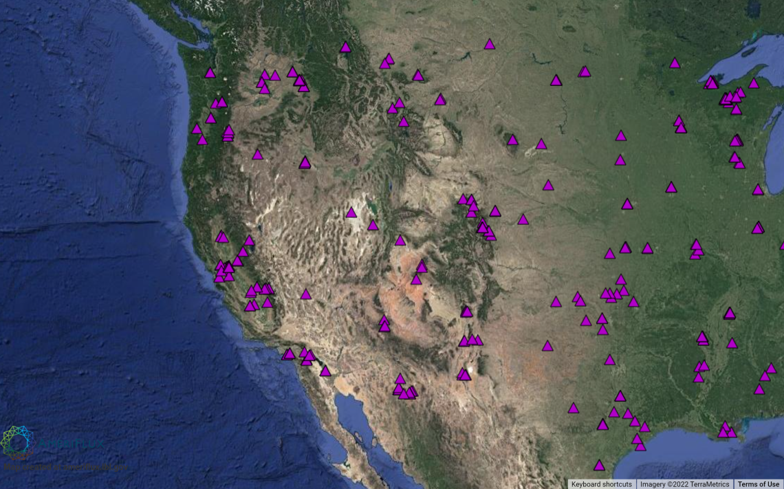
Today, eddy covariance measurements of carbon dioxide and water vapor exchange are being made routinely on all continents. The flux measurement sites are linked across a confederation of regional networks in North, Central and South America called AmeriFlux and other networks for the regions of Europe, Asia, Africa, and Australia, in a global network, called Fluxnet. This global network includes more than eight hundred active and historic flux measurement sites, dispersed across most of the world’s climates and representative biomes/ecosystems. Within this larger network, smaller meso-networks target specific land use types, such as Arizona rangelands, urban areas, and forests, within a region. Many of these locales serve as focal points for sets of ecosystem-scale ‘manipulative’ studies. There, comparative flux measurements are being made at satellite-sites that may differ by plant functional type, biophysical attributes, biodiversity, time since disturbance (e.g., fire, logging, wind throw, flooding, or insect infestation), or management practices (e.g., fertilization, irrigation, or cultivation). Distinct scientific attributes of the flux network include its ability to detect emergent scale properties of ecosystem metabolism at local to regional and global scales and quantify temporal and spatial variability in carbon, water, and energy fluxes.
Part of the text provided on this page is from https://fluxnet.org/.
ARS_Ameriflux-custom-map.png